The physics of motorless flight: How thermals form, how ridge lift works, and why wave pilots can climb into the stratosphere.
Soaring Explained — Thermals, Ridge Lift, Mountain Waves and How to Use Them
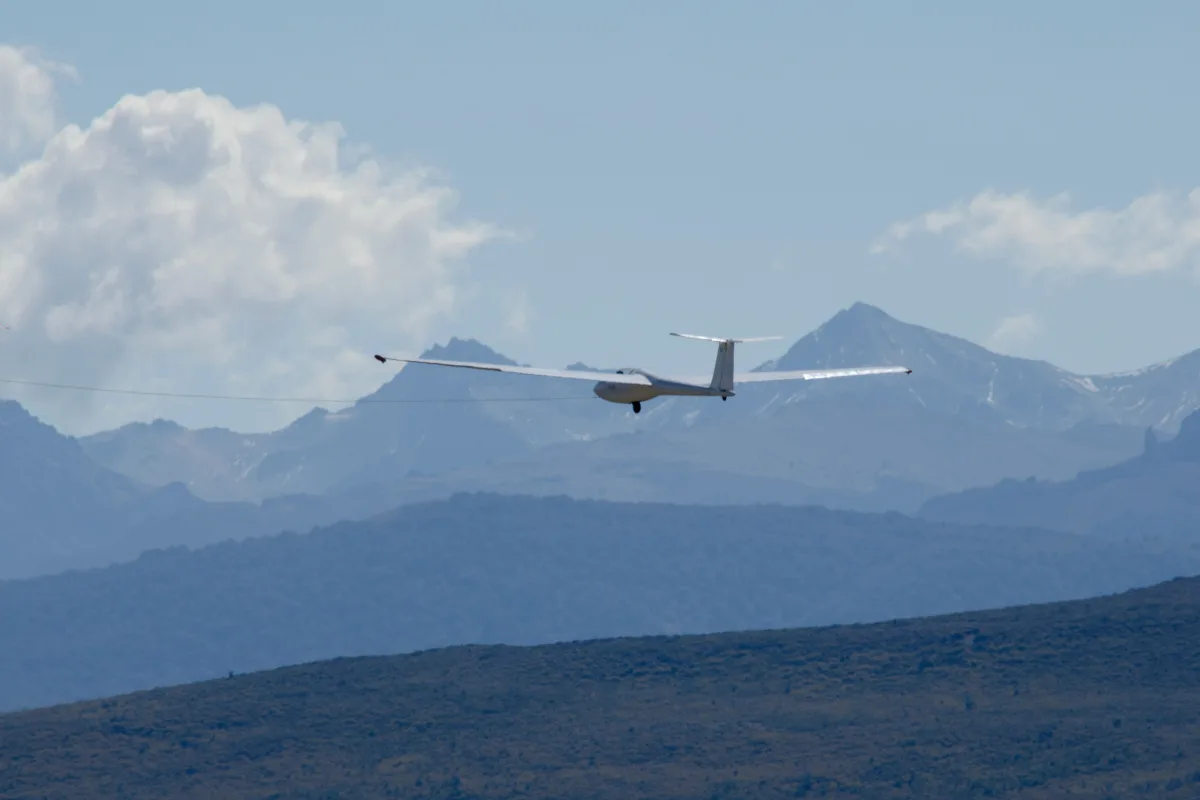
Soaring is the purest form of flight: staying aloft for hours and covering hundreds of miles without an engine, powered solely by the energy of the atmosphere. The key lies in understanding the lift sources that nature provides. Whether thermals over sun-heated fields, ridge lift along mountain ranges, or powerful mountain waves — each type of lift has its own characteristics, hazards, and techniques. This article explains the physical principles, offers practical tips for finding and using lift, and shows why soaring is one of the most fascinating disciplines in aviation.
Thermals — the engine of soaring
Thermals are the most important lift source for glider pilots. They form when the sun heats the ground unevenly, causing the air above to rise. Dark surfaces such as freshly plowed fields, asphalt areas, or dark forest edges heat up faster than lighter surfaces like meadows or bodies of water. The heated air detaches from the ground and rises as a thermal bubble or thermal column.
Bubble thermals and column thermals
There are two fundamental forms of thermal. Bubble thermals occur when a limited mass of air heats up at the surface, detaches, and rises as a self-contained bubble. This type is typical of early morning hours and weak solar radiation. The bubble has a diameter of roughly 300 to 1,000 feet and rises at 2 to 6 knots. For the pilot, bubble thermals are harder to exploit because the bubble drifts and must be followed.
Column thermals, on the other hand, form under stronger solar radiation and stable triggering. Here a continuous column of rising air extends from the ground up to the convective ceiling. Column thermals can produce climb rates of 6 to 16 knots and are the preferred lift source for cross-country pilots. The column typically has a diameter of 600 to 1,600 feet, with the strongest lift concentrated in the core.
Thermal triggers
Experienced glider pilots know the typical trigger points where thermals tend to form:
- Terrain edges: Transitions from forest to field, ridge lines, edges of towns
- Dark surfaces: Freshly plowed fields, industrial areas, quarries
- Slope orientation: South- and west-facing slopes heat up earlier in the day
- Convergence lines: Where different air masses flow together
- Urban fringes: The heat island effect of cities reliably generates thermals
Bodies of water also play a role — but as thermal suppressors. Air cools over lakes and rivers, which is why these areas should be avoided when hunting for thermals. Forests can act as either triggers or suppressors depending on the season: in spring, when the trees are still bare, the dark forest floor can heat up significantly.
Centering the thermal and circling technique
Centering a thermal is one of the most important skills in soaring. When the variometer shows increasing climb, the pilot flies straight ahead until the climb weakens. Then a turn is initiated toward the direction of the strongest lift. Thermalling technique requires tight circles at 30 to 45 degrees of bank at a speed just above the minimum for the given bank angle.
The rule of thumb is: When the climb increases, widen the turn; when it decreases, tighten the turn. This gradually shifts the center of the circle into the strongest lift. Experienced pilots also account for wind drift: in wind the thermal column drifts downwind, so the pilot must correct slightly into the wind on each circle.
"Good thermalling separates the cross-country pilot from the pattern flyer. Half a knot more from every thermal translates into 30 extra miles at the end of the day." — Hans-Werner Grosse, cross-country soaring legend
Modern gliders are equipped with speed-to-fly computers (also known as MacCready rings or electronic flight computers) that show the pilot the optimal inter-thermal cruise speed for maximum average cross-country speed. The stronger the expected thermal, the faster the pilot should fly between thermals.
Ridge lift — lift from terrain
Ridge lift occurs when horizontal wind strikes an obstacle — typically a mountain ridge, cliff, or hill — and is deflected upward. This type of lift is independent of thermals and works even under overcast skies, as long as there is sufficient wind.
Ridge soaring — fundamentals and technique
When ridge soaring, the pilot flies back and forth parallel to the ridge (known as "beating") and exploits the band of lift that forms on the windward side. The usable lift band typically extends from about halfway up the slope to roughly 1.5 times the ridge height above the crest. The width of the usable lift band ranges from about 300 to 1,600 feet depending on the ridge profile.
The following rules apply for effective ridge soaring:
- Minimum wind speed: Approximately 8 knots perpendicular to the ridge is needed to produce usable lift
- Optimal wind speed: 14 to 22 knots provides the best climb rates
- Wind direction: The wind should strike the ridge as close to perpendicular as possible; deviations beyond 30 degrees significantly reduce the lift
- Turns at the ridge: Always turn away from the ridge, never toward it
- Right-of-way rule: The glider closest to the ridge has priority
Terrain features and their influence
Not every ridge is equally suited for ridge soaring. Slope steepness plays a decisive role: steep slopes (over 30 degrees) produce stronger but narrower lift bands. Shallow slopes (10-20 degrees) offer wider but weaker lift. The ideal slope angle is approximately 25-35 degrees.
Convex slope profiles (curving outward) are particularly favorable because they deflect the wind upward smoothly. Concave features (hollows, valleys) can create turbulence and downdrafts. Promontories and protruding ridge points are especially strong lift generators and are favored by experienced ridge pilots.
In the Alps, the Appalachian ridges, and along mountain chains worldwide there are numerous well-known ridge-soaring sites. The Appalachian Ridge in the eastern United States is one of the world's premier ridge-soaring regions — in northwest winds, pilots can fly for hours along the continuous ridgeline.
Mountain wave flying — the ultimate challenge
Mountain waves are standing gravity waves that form on the downwind (lee) side of mountain ranges. They are among the most powerful lift sources in the atmosphere and can carry gliders to altitudes above 30,000 feet. The physics behind them: when stable air layers flow over a mountain range, they oscillate like a guitar string, creating alternating bands of rising and sinking air.
Formation and structure of mountain waves
Several conditions must be met for mountain waves to form:
- Strong wind: At least 16 knots at ridge-top level, increasing with altitude
- Stable layering: A stable air layer (inversion) at or just above ridge height
- Consistent wind direction: Wind direction should change little with altitude (less than 30 degrees of veering)
- Suitable terrain: A prominent ridge running roughly perpendicular to the wind direction
The wave structure consists of several elements: the primary wave directly behind the mountain, followed by the secondary wave and additional waves at intervals of 3 to 18 miles (wavelength). Below the waves, rotors form — highly turbulent rolling vortices that can be dangerous for gliders. The climb into the wave often passes through the rotor, which brings significant turbulence and abrupt direction changes.
Lenticular clouds as wave indicators
Lenticular clouds (altocumulus lenticularis) are the visible indicators of mountain waves. These lens-shaped, smooth-contoured clouds remain stationary in the sky even though the wind blows through them at high speed. They form in the rising portion of the wave where the air cools to its dewpoint, and they dissipate in the sinking portion. Multiple lenticulars stacked above each other ("pile of plates") indicate particularly strong wave systems.
At the surface, the wave often manifests as a foehn wall on the windward side and a rotor cloud — a ragged-looking cloud below the lenticular. Experienced wave pilots can accurately gauge the strength and position of the lift bands from these cloud formations.
Record flights in wave
Mountain waves have enabled the most impressive records in soaring. The absolute altitude world record stands at 76,124 feet (23,202 meters), set by Steve Fossett and Einar Enevoldson in 2006 in a Perlan Project glider over the Andes — an altitude where survival is impossible without a pressure suit and supplemental oxygen. In Europe, altitudes above 33,000 feet are regularly reached in Pyrenean and Alpine waves.
| Wave Region | Location | Typical Altitudes | Best Season |
|---|---|---|---|
| Andes | Argentina | up to 49,000 ft+ | June-September |
| Sierra Nevada | California, USA | up to 40,000 ft | Fall-Winter |
| Pyrenees | France/Spain | up to 33,000 ft | Fall-Spring |
| Alps | Central Europe | up to 26,000 ft | Fall-Spring |
| Owens Valley | California, USA | up to 35,000 ft | Spring-Summer |
Convergence lift — the underestimated lift source
Convergences occur when different air masses meet. At the boundary, the warmer or moister air is lifted, creating linear bands of rising air. Common convergence types include:
- Sea-breeze convergence: Along coastlines and large lakes, cool air flows inland during the day and meets the heated air over land
- Valley-wind convergence: In mountainous terrain, valley wind systems from different valleys collide
- Frontal convergence: Ahead of cold fronts or squall lines
- Thermal convergence: Different land use patterns create locally varying thermal strengths, which produce converging airflows
Convergence lines are especially valuable for cross-country pilots because one can often fly straight ahead in lift along the line without circling. The art lies in recognizing them — they are frequently marked by cloud streets that line up in a row.
Practical tips for finding lift
Beyond understanding the physics, there are numerous practical indicators that help pilots find lift:
- Cumulus clouds: Every cumulus cloud marks an active or recently active thermal column. Dark, flat cloud bases indicate strong thermals
- Watch cloud development: Growing cumuli are active; decaying clouds mark dying thermals
- Birds: Circling raptors, eagles, hawks, or vultures reliably indicate thermals
- Other gliders: Circling gliders nearby are a sure sign
- Surface features: Dust devils, smoke rising upward, or fluttering flags indicate thermal release
- Shadow analysis: Cloud shadows on the ground reveal where sunshine is hitting and where it is not
Meteorological preparation
Thorough meteorological preparation is essential before every soaring flight. Key information sources include:
- SkySight: High-resolution thermal and wave forecasting tool used worldwide
- RASP/BLIPMAPS: Regional thermal forecast maps popular in the US and UK
- XCSkies: Cross-country soaring forecast tool for North America
- Sounding diagrams (Skew-T): Radiosonde profiles show the atmospheric layering
- Webcams and observations: Real-time cloud imagery from airfields
The experienced glider pilot analyzes the convective ceiling (base of cumulus clouds, typically 5,000-10,000 ft AGL in summer), the trigger temperature (the surface temperature at which thermals begin), and potential overdevelopment (thunderstorms) that can cut the flying day short.
Safety when exploiting lift
Each type of lift comes with specific hazards. In thermals, the greatest danger is a midair collision with other circling aircraft — therefore the rule is: always join an established thermal in the same direction of turn as aircraft already circling, and maintain constant lookout. On the ridge, the dangers include being undercut and terrain collision if the wind drops. When wave flying, the main risks are rotor turbulence, hypoxia at high altitudes, and icing.
Regardless of the lift type: Never descend below your safety altitude. Every pilot must always have a reachable landing area within glide range — whether the home airfield, a landable field, or an airport along the route. A field landing (off-airport landing) in a suitable field is a normal event in soaring, not an emergency, as long as it is planned in time and executed properly.
Soaring uniquely combines understanding of nature, piloting skill, and meteorological knowledge. For those who learn to read and use the atmosphere's lift sources, a three-dimensional playground of breathtaking beauty opens up — silent, emission-free, and endlessly fascinating.